
Picture 1 of 12


Picture 1 of 12


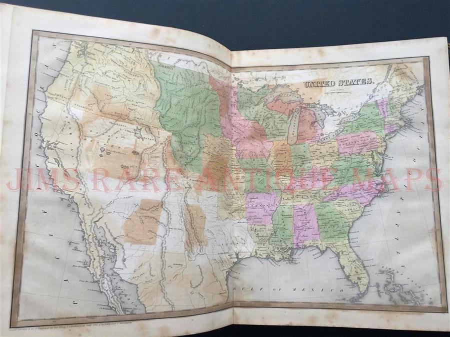

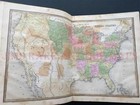
1842 BRADFORD UNIVERSAL ILLUSTRATED ATLAS, "REPUBLIC TEXAS MAPS" RARE ANTIQUE

Condition:
“1842 BRADFORD ATLAS, .UNIVERSAL ILLUSTRATED World ATLAS.218 pp. With 50 engraved map sheets (the ”... Read moreabout condition
Shipping:
Located in: Rockford, Michigan, United States
Delivery:
Estimated between Tue, Apr 23 and Thu, Apr 25 to 43230
Returns:
Payments:
*No Interest if paid in full in 6 months on $99+. See terms and apply now- for PayPal Credit, opens in a new window or tab
Earn up to 5x points when you use your eBay Mastercard®. Learn moreabout earning points with eBay Mastercard
Shop with confidence
Seller assumes all responsibility for this listing.
eBay item number:162393964042
Item specifics
- Seller Notes
- Country/Region
- United States of America
- Maker
- Thomas Gamaliel and Samuel Griswold Goodrich
- Type
- Atlas
- Year
- 1842
- US State
- AK, HI, AL, FL, GA, MS, NC, SC, Alabama, Alaska, AR, IA, KS, LA, MO, NE, Arizona, Arkansas, AZ, CA, CO, NM, NV, UT, Colorado
- Printing Technique
- Copper Plate
- Format
- Atlas
- Original/Reproduction
- Original
- Date Range
- 1800-1899
- Canadian Province
- Alberta, British Columbia, Manitoba, New Brunswick, Newfoundland & Labrador, Northwest Territories, Nova Scotia, Nunavut, Ontario, Prince Edward Island
- Mexican State
- Aguascalientes, Baja California, Baja California Sur, Campeche, Chiapas, Chihuahua, Coahuila, Colima, Durango, Guanajuato
- Cartographer/Publisher
- Charles D Strong
Item description
Seller assumes all responsibility for this listing.
eBay item number:162393964042
Shipping and handling
Item location:
Rockford, Michigan, United States
Ships to:
United States
Excludes:
Barbados, French Guiana, French Polynesia, Guadeloupe, Libya, Martinique, New Caledonia, Reunion, Russian Federation, Ukraine, Venezuela
| Shipping and handling | To | Service | Delivery*See Delivery notes |
|---|---|---|---|
| Free shipping | United States | Expedited Shipping (USPS Priority Mail®) | Estimated between Tue, Apr 23 and Thu, Apr 25 to 43230 |
| Handling time |
|---|
| Will usually ship within 1 business day of receiving cleared payment. |
| Taxes |
|---|
| Taxes may be applicable at checkout. Learn moreLearn more about paying tax on eBay purchases. |
Return policy
| Return policy details |
|---|
| Seller does not accept returns |
Refer to eBay Return policyopens in a new tab or window for more details. You are covered by the eBay Money Back Guaranteeopens in a new tab or window if you receive an item that is not as described in the listing.
Payment details
Payment methods
Seller feedback (204)
1***k (550)- Feedback left by buyer.
More than a year ago
Verified purchase
Great item, carefully packed, A+++
More to explore :
- Texas Antique North America Atlas Maps,
- Texas County Map Antique North America Atlas Maps,
- Texas Political Map Antique North America Atlas Maps,
- Czech Republic Antique Europe Atlas Maps,
- Texas Railroad Map Antique North America Atlas Maps,
- Antique Atlas Maps,
- World Atlas Antique Atlas Maps,
- Topographical Map Antique Atlas Maps,
- Reproduction Antique Atlas Maps,
- Antique Original Political Map Antique Atlas Maps